preserving the balance of nature
Hannah Della Bosca Papers
The following are papers written or co-written by Hannah Della Bosca
16 April 2018
The coal story: Generational coal mining communities and strategies of energy transition in Australia
Hannah Della Bosca, Josephine Gillespie
7 May 2018
The construction of ‘local’ interest in New South
Wales environmental planning processes
Hannah Della Bosca, Josephine Gillespie
30 October 2019
Bringing the swamp in from the periphery: Australian wetlands as sites of climate resilience and political agency
Hannah Della Bosca, Josephine Gillespie
2020
Disaster, Place, and Justice: Experiencing the Disruption of Shock Events
David Schlosberg, Hannah Della Bosca and Luke Craven
9 February 2020
Shock and place: reorienting resilience thinking
Hannah Della Bosca, David Schlosberg & Luke Craven
1 December 2022
Multispecies Grief in the Wake of Megafires
Nathaniel Otjen, Lena M. Schlegel, Shannon Lambert, Hannah Della Bosca, Blanche Verlie
2023
Comfort in chaos: A sensory account of climate change denial
Hannah Della Bosca
2024
Sweat speaks: Stories of embodiment, emotion, and erasure on a heating planet
Hannah Della Bosca
12 June 2024
Critical environmental justice in contemporary scholarship and movements: consensus and plurality of the discourse
David Schlosberg, Lauren Rickards, Rebecca Pearse, Hannah Della Bosca & Oli Moraes
28 February 2025
Compounding barriers to environmental justice
Rebecca Pearse, David Schlosberg, Lauren Rickards, Hannah Della Bosca, Oli Moraes & Lisa de Kleyn
2026
Realising environmental justice: Strategy and tactics for transformation
David Schlosberg, Lauren Rickards, Hannah Della Bosca, Rebecca Pearse and Oli Moraes
Destination Pagoda Economic Report 2020
This report was commissioned by the Colong Wilderness Foundation Ltd on behalf of the Gardens of Stone Alliance to assess the profile of potential visitors to Gardens of Stone State Conservation Area and the economic contribution of those visitors to the local region. The Alliance has produced a visitor plan for the proposal under the title of Destination Pagoda.
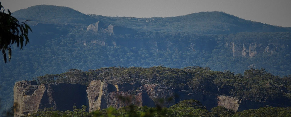
The proposed Gardens of Stone State Conservation Area (GSSCA) refers to a 39,000 ha area of natural beauty and Aboriginal heritage on the edge of Lithgow and 140 kms from Sydney. The area is widely considered to be the traditional Country of the Wiradjuri people currently managed as State Forest and other Crown land. The region has iconic pagoda rock landscapes found nowhere else in the world, Aboriginal rock art and a unique flora of swamps and forests with 84 threatened plants and animals. The unique attractions of the area show strong potential to attract an increasingly large segment of nature-based tourists to the Lithgow LGA. This benefit depends on the area being given effective protection and management as a State Conservation Area (SCA).
Wildflower Brochure
Gardens of Stone Visitors Map
Visit and learn about the magnificent Gardens of Stone region on the western side of the Blue Mountains and easily accessible from Sydney or the Central West. The Gardens of Stone Visitors Map shows trails, views and other main attractions.
Only two hours drive from Sydney, the Gardens of Stone offer many family adventures from picnicking and sightseeing to day walks, camping, nature study, exploring industrial ruins, bird-watching, bicycling, photography, drawing and painting. The Visitors Map is full of suggested walks and trips.
There are lots of opportunities for multi-day walks, rock climbing, abseiling and cannoning. Accommodation is readily available in Lithgow and other nearby towns.
The Visitors Map is in full colour, 60 by 85 cm in size, and covers the entire Gardens of Stone region at a 1:100,000 scale, making it ideal for planning your next trip to the area.
Well illustrated with colour photos, the reverse side has lots of information on the plants, animals, pagoda rock formations, cliffs as well as the cultural and historic places in the region.
This map has been prepared by the Gardens of Stone Alliance (Blue Mountains Conservation Society, Colong Foundation for Wilderness and Lithgow Environment Group) to promote the conservation of the Gardens of Stone Stage 2 Reserve Proposal and to showcase the many low-impact recreational opportunities in the area.
There are touring routes for motor vehicles and bicycles which readily link to other routes in the Greater Blue Mountains and World Heritage Area.
National Pollutant Inventory
The National Pollutant Inventory (NPI) provides the community, industry and government with free information about substance emissions in Australia. It has emission estimates for 93 toxic substances and the source and location of these emissions.
Fauna of the Upper Coxs River Catchment Report
This study was conducted as a component of the Natural Science degree at the University of Western Sydney on behalf of Lithgow Environment Group. It was observed that semi-aquatic animals were more prevalent at Marrangaroo Creek than along the more degraded main freshwater system of the Upper Coxs River catchment, NSW. The aim of the study was to establish whether or not there was a relationship between river condition and species diversity by comparing ecologically similar sites within a high-demand landscape. To achieve this, three common freshwater macro-fauna species were selected – the platypus, eastern water rat, and a selection of waterfowl – and comparatively assessed, along with key habitat resources analogous to all target species. These habitat resources included macro-invertebrate assemblage, water quality, and riparian condition. Three test sites were selected along the main land-use stretch of the Upper Coxs River, along with two additional contextual sites at Lake Wallace and Lake Lyell, and compared to a relatively un-impacted reference site at Marrangaroo Creek.
The Geoheritage and Geomorphology of the Sandstone Pagodas
Abstract: The geoheritage and geomorphology of the sandstone pagodas of the north-western Blue Mountains region (NSW). Proceedings of the Linnean Society of New South Wales 132, 131-143. The towered 'pagoda' rock formations of the north-western Blue Mountains, west of Sydney, have a heartland of about 600 km 2 , mostly at around 1000 metres altitude in Banks Wall and Burra Moko Head Sandstones. The pagodas are of two types: the 'platy pagodas' are generally stepped-cones in shape, with semi-regular ironstone bands, whereas the 'smooth pagodas' display less ironstone bands and are similar to many slickrock slopes found elsewhere. The platy pagodas however are an uncommon and significant geomorphic landscape feature, and are distinguished by the extent and regularity of their ironstone banding. The formation of the ironstone banding has involved the movement of iron in solution and its precipitation to form resistant bands, swirls and pipes. Questions remain as to how the ironstone banding formed, however 'roll fronts' of reaction between reduced Fe 2+ -rich water and oxygenated water may best explain the amazing ironstone shapes. The geoheritage value of the pagodas is significant, but is threatened by activities such as longwall coal mining. The pagodas and the associated slot canyons of the Blue Mountains are ideal candidates for future geological and geomorphological research.